NASA's Latest Image Shows What an "Earthrise" as Seen From the Moon Looks Like
A stunning recreation of the original 1968 image.

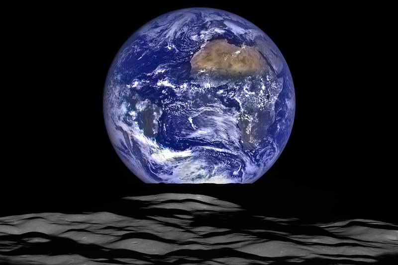
NASA has just released a stunning mosaic image of the Earth ‘rising’ over the surface of the Moon, as it was captured by the Agency’s Lunar Reconnaissance Orbiter (or LRO, for short). The image was created using the LRO’s narrow and wide angle cameras in order to create a colorful composite image that reflects the colors of the Earth as they would be seen by explorers from the surface of the moon. Of course, there is some trickery at play here: the same side of the Moon is always facing the Earth, due to the latter’s tidal lock on the satellite; so the only way to witness the iconic ‘Earthrise’ as it is photographed would be to be in orbit around the Moon. As NASA put it in its blog post:
In this composite image we see Earth appear to rise over the lunar horizon from the viewpoint of the spacecraft, with the center of the Earth just off the coast of Liberia (at 4.04 degrees North, 12.44 degrees West). The large tan area in the upper right is the Sahara Desert, and just beyond is Saudi Arabia. The Atlantic and Pacific coasts of South America are visible to the left. On the moon, we get a glimpse of the crater Compton, which is located just beyond the eastern limb of the moon, on the lunar farside.
It’s one hell of a view. Head over to NASA’s blog for more information on the image and its creation, and keep in mind that this might be the last image of its kind until the Space Agency gets funding to send another crew up there by the mid-2020s. And if that doesn’t satisfy your appetite for outer space, click here to read HYPEBEAST’s interview with UrtheCast CEO Wade Larson.


